The Routes
The Pisidia Heritage Trail mostly develops across the forested highlands of the Taurus Mountains, at altitudes between 700 and 1100m above sea level. Even in the summer months, the region is therefore cooler than the surrounding coastal areas. The lush vegetation cover is characterised by old forests of oaks, cedars and pines, and particularly in the more remote locations is home to a wide variety of local plant and animal species that can only be found in Pisidia. Some of the highlights include the meandering banks of the Aksu River, the natural pool and the 50m-high waterfall of the Uçan Şelale, as well as two of the most striking rock formations in Turkey, the Erikli Yayla and Köprülü Canyons. The Köprülü Canyon is further famous for its rafting facilities, which sport over 14km of easy rafting course over clear emerald waters.
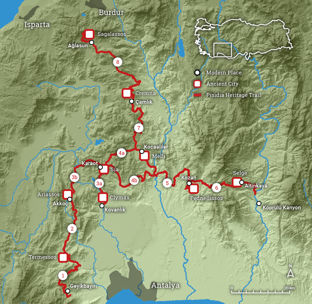
You can visit the ancient cities for a single day coming from Antalya, or you can plan to walk longer stretches along it, starting from several possible points along the trail. There are 8 main routes that cover a total of 350km, and each route can be accessed from intersections with asphalted roads. Camping along the trail can be done between March and November.
You can download a GPS dataset marking the trail, with all available water sources, camping spots, archaeological sites, and natural viewpoints here.
A booklet describing these individual routes is accesible here.
1. Trebenna – Termessos (39 km)
2. Termessos – Ariassos (36 km)
3. A. Döşemeboğazı – Sia (20 km)
B. Ariassos – Panemoteichos – Sia (27 km)
4. A. Sia – Melli (20 km)
B. Sia – Kocain – Melli (43 km)
5. Melli – Pednelissos (47 km)
6. Pednelissos – Selge (37 km)
7. Melli – Cremna (45 km)
8. Cremna – Sagalassos (52 km)


